Image

The third annual Data-to-Impact (D2I) Challenge, co-led by the University of Virginia School of Data Science, the UVA National Security Data and Policy Institute (NSDPI), and LMI, invited student teams from across the University to apply data science to real-world problems. This year’s challenge theme explored the expansion of data centers and their impact using data science. Student groups could approach this topic from any lens, including technical, environmental, cultural, policy, or security.
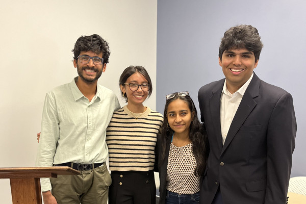
The D2I Challenge is grounded in the idea of data science as a force for positive change. Nearly 50 students registered from six different schools, demonstrating cross-Grounds participation and collaboration. Six teams were selected as finalists, presenting the culmination of several months of research and analysis on Friday, Feb. 13, before a panel of judges. The panel included Kristen Cheman, senior vice president of the intelligence market at LMI; Jonathon Hathaway, research program director at NSDPI; Maura Austin, senior research scientist at NSDPI; Daniel Graham, associate professor at UVA’s School of Data Science; and Chris Parrett, director of the Rapid Capabilities Office at the National Geospatial-Intelligence Agency (NGA). Final presentations demonstrated such impressive technical depth, thoughtfulness, and quality that all finalists received awards and cash prizes totaling over $4,000 this year.

First place went to the ML@UVA AL team, featuring students Kyle Luong, Donghwa Shin, Shahzaib Tariq, Abhishek Satpathy, and Arjun Malghan. In their presentation, they discussed the challenges surrounding evaluating appropriate sites for creation of new data centers. To address this issue, the team built querylite, a testbed for sample-efficient data center site selection.
They used real geospatial data from six government APIs and surrogate models trained on limited query budgets. They also did a head-to-head comparison of two different paradigms of sample efficient methods: design of experiments and active learning. They tested their paradigms on classic benchmarks and were able to find data center sites that outscored all the existing sites.
“For future work, we want to incorporate richer signals,” Luong said. “With AL you can get more useful data across a larger scale.”
Judges and technical executives were impressed with the team’s technical approach, presentation, and pitch. “You’re helping uncover the decision-making process behind data centers,” Brant Horio, vice president of applied research and partnerships at LMI, said. “This is really important stuff, to be able to figure out what is driving these decisions.”

Second place went to the ML@UVA Alpha team, consisting of Raffu Khondaker, Kabir Minhas, Rishi Kandimalla, Jahleel Jackson, and Rohan Soma. With their project, Tracking Infrastructure-Scale Regime Shifts with AlphaEarth, they sought out to monitor the lifecycle of data centers without relying on speculative predictions or labor-intensive manual image review.
The result was an embedding-driven geospatial intelligence platform powered by Google AlphaEarth that unifies environmental data, forecasting, and spatial analysis. Using Model Context Protocol (MCP) for tool-augmented reasoning, it converts natural language queries into workflows that enable users to predict environmental change and assess data center expansion with high precision.
“We looked into how do you visualize 64 dimensions; how do you understand where concepts lie?” Khondaker said. “That was a huge undertaking.”

The CCRLO team won third place for their project, Environmental Concern Data Center Construction Dashboard. Team members were Olivia Smith, Rachel Earl, Catherine Kim, and Cooper Carlson.
The team recognized the rapid expansion of data centers in NOVA and the pressure that this puts on environmental factors. They created a data-driven, geospatial decision dashboard to evaluate possible locations to build NOVA data centers in relation to environmental factors. They decided to use four different layers in their model: water stress, heat stress, land use, and infrastructure.
“The first thing that we did was look at the aqueduct water risk atlas,” Smith said. “We decided to take a look at their methodology and simplify it. Water stress is a very critical factor because data centers are inherently very water intensive for cooling.”
They found that sustainable siting often conflicts with built infrastructure, and that more suitable suites are clustered where lower water stress intersects with high infrastructure availability.
“It’s very difficult to find and calculate these sites in terms of which is the best when we’re looking at sizeability and constraints, and that is very difficult as we’re increasing the number of data centers,” Earl said.
The judges were impressed with their presentation and appreciated the team’s conscientiousness around how the data they gathered could be used.

Team Karen and Eva, made up of Karen Guzman and Eva Winston, received an honorable mention for their project, Data Center Transparency & Accountability Framework. They were motivated to enter the competition by the lack of data on data centers. They were concerned that most people don’t know much about potential new data centers being built in their communities, which are stressing the electrical grid and leading to higher electric bills. As part of their project, they created a mandatory disclosure tool to transform the tax exemption into a performance-based incentive to create transparency, enable smart policy, protect community, and maintain competitiveness.
“Data centers are coming up so fast that it’s kind of a harsh pivot, but a necessary one to force them to be competitive with one another in terms of being sustainable,” Winston said.
“Our goal would be transparency for everyone involved,” Guzman added. “Communities would be able to see exactly what the policy makers see so everyone has the same knowledge base.”
Cheman mentioned that she could see this tool gaining a lot of momentum right now if it was made accessible to the public.

Team Gridguard included Vinith Jayamani, Anay Upadhyay, Abhinav Pappu, and Mason Nicoletti. Their project, AI Infrastructure ESG Atlas, addressed the challenge of finding sites for new data centers while balancing power demands and environmental risks through the creation of a predictive heatmap. Their tool enables planners to predict site-specific impacts and avoid high risk locations.
“We really wanted to see a connection or correlation between lower-income communities and how the power centers are putting a strain on these communities,” Jayamani said. “We wanted to steer the growth from high-risk areas to sustainable areas.”
They described how planners could utilize the tool to simulate what would happen on the real power grid if a data center was built in a certain location.

Sahana Krishnaraj and Divya Ramakrishnan of the Cloud Chasers team created a Data Center Environmental Siting Optimizer to demonstrate how environmental responsibility and operational performance can coexist in data center siting.
“Our solution is an interactive web application that quantifies environmental trade-offs in data center siting,” Ramakrishnan said.
She described how users can weight five different environmental metrics to get an output for the county’s rank. “It gives them confidence to speak up to their local government. Policy makers can use our web application to draw zoning regulations and bring that into the conversation when talking about if we can build data centers in different locations.”
One judge commented on how well the Cloud Chasers thought through implementation of their web application as well as next steps.
After judges deliberated, the final standings were decided by razor-thin margins. All six teams received awards and made an excellent impression on both professors and technical executives across industry and government.
Following the challenge, student presenters were invited to present their work to a broader group of National Geospatial-Intelligence Agency, NSDPI, and LMI leaders in a follow-up session.
LMI, a founding industry partner of the School of Data Science, has sponsored research capstone projects with numerous data science master's students, some of whom joined LMI after graduation.
Participants were encouraged to participate in next year’s D2I Challenge, which will launch at Datapalooza 2026.

Subscribe to receive updates from the School of Data Science.